Data Gathering &
Drone Use in Mining
Learn More
Drones in Mining
Lidar & Photogrammetry Solutions for Drones in Mining Operations
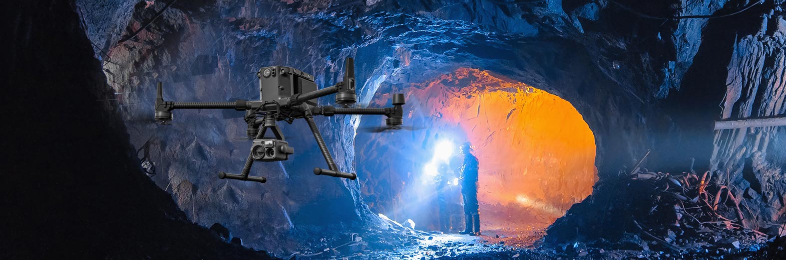
TruNorthe Data Solutions specializes in a wide range of data collection verticals and business uses in the drone space. This includes a specialization in the consulting, designing, implementing, and execution of drone programs in the mining sector. Drone use cases in mining can add enormous value by informing operations and decisions and making for more efficient and safer operations across the sector.
Drones are not a solution that can be implemented casually if they are to maximize the value and safety in this challenging sector. These programs must be deliberately built from the ground up to meet the specific needs of the company and its programs. TruNorthe will help navigate this entire process and provide not only turnkey services but also help create scalable programs that can continue to grow and adapt from a solid foundation.
SLAM LIDAR
Data Capture in GPS/GNSS Denied Areas
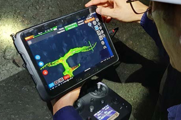
By using specialized SLAM LIDAR systems, we provide a means to navigate areas where GPS/GNSS systems are not viable. These specially designed LIDAR systems not only provide autonomous navigation without GPS or supplemental lighting but also map and collect the desired data while doing so.
These systems can inform decision making at every level of management, improve safety by limiting personnel exposure, lead to savings in the implementation of informed decisions and efficiency increases in operations, and save on equipment costs over the legacy means of mapping and data collection in underground networks.
Photogrammetry
3D Data Capture from Aerial Platforms
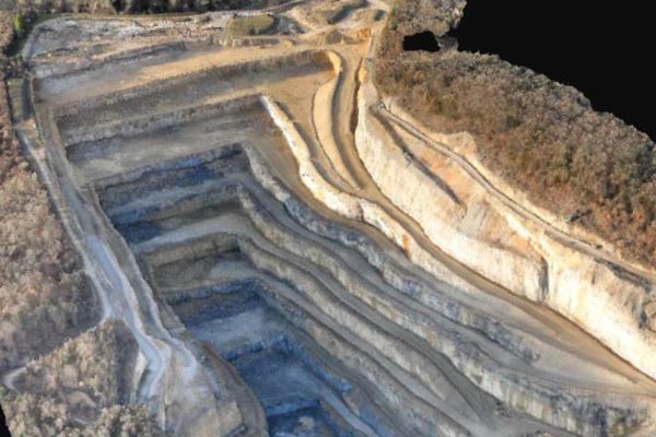
For above ground mines and quarries TruNorthe can provide or build solutions that allow for the use of photogrammetry to construct scalable georectified 3D models. These models are constructed using thousands of high-definition pictures and assembled into 3D models that can be used at every level of site management.
The models can provide georectified data that allows for surveying, planning, cut and fill measurements, volume calculations, demolition planning, site progress tracking, and post use site monitoring. These models can be built as a single model or models over time that allow comparisons and measurements to be taken and referenced at every stage of operations thus providing an enduring data set with value far into the future.
Mining Use Case Studies
Drones in Mining and Specific Applications at All Levels of Operations
The following are specific use cases for our SLAM LIDAR applications and autonomous drone navigation in areas without light or GPS/GNSS signals.
These environments present a unique challenge to drone use but the team at TruNorthe can help navigate this particularly challenging environment.
The solutions we will work with you on not only allow for safe autonomous drone usage but can also be hand carried, mounted on robotic ground vehicles, mounted on trucks and other vehicles, lowered in a shaft, or swapped between any of the above.
Many of the same technologies and principals can be applied to above ground mines and quarries with similar volume and survey quality measurements. For further information or demonstrations contact TruNorthe and we will work with you to match the right technology with your desired outcome and budget and help you integrate this new technology into your future projects.
Development Over-Break
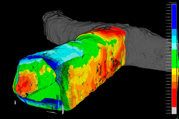
Our vehicle, handheld, and unmanned systems enable data to be collected rapidly in development areas without interrupting activity or risking the safety of personnel. Comparing the as-built to the as-design provides a detailed over-under-break analysis and identified areas outside of tolerances.
Development Pickups and Cut Volumes
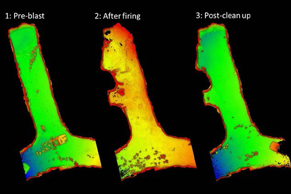
A heading can be scanned within minutes using LIDAR. Operators are able to capture data shortly after firing, before other development activities commence. Detailed point cloud data provides development shapes that enable development pickups. LIDAR data can also be used for more detailed analytics, such as calculating moved material volumes, bulking factors, and reconciliation.
Comparing pre- and post-blast scans can determine the in-situ rock volume, the post-blast bulked volume and the bulking factor.
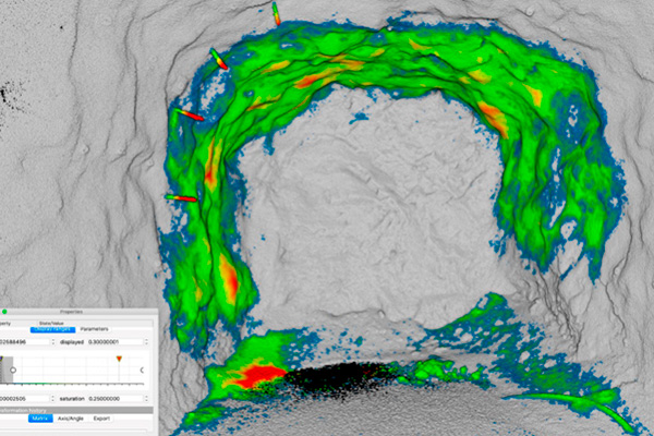
Convergence Monitoriing
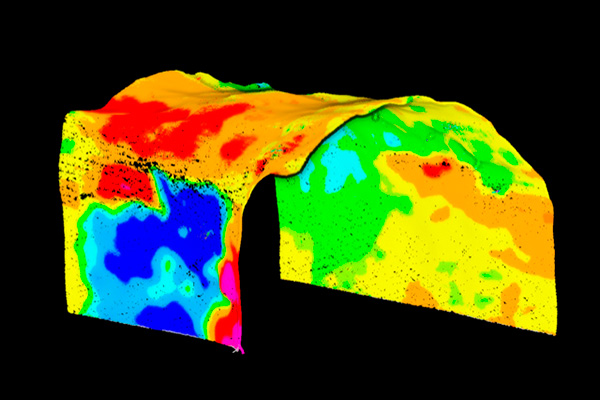
To maintain a safe working environment in any underground operation, accurate monitoring of ground support is essential. SLAM LIDAR scans, captured by walking, vehicle, or flight, provide insights that are superior to those obtained from broad scale observational mapping or traditional extensometer readings.
Data accuracy is sufficient to identify changes exceeding 5 mm. Rapid scanning methods enable data collection to occur at regular intervals. This leads to improved recognition of convergence trends and closure rates. As a result, residual capacity can be estimated more accurately, and rehabilitation schedules optimized accordingly.
Structure Detection
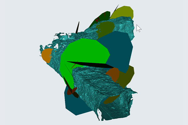
Our LIDAR high resolution point clouds are compatible with automated structural recognition programs, such as Maptek PointStudio, Sirovision and CloudCompare, the popular open-source point cloud analytics software.
In this example, the identified structures have sufficient scale to control the drive profile. More comprehensive characterization of the rock mass would include window mapping to identify other potential contributing factors.
Shotcrete Thickness
LIDAR can be used to record the void, structures, and ground support, prior to shotcrete application. This data can provide a baseline for future analysis and audits.
Conducting a second scan of the surface after shotcrete has been applied allows engineers to determine whether the application is within specification and matches the invoiced volume. This second scan can also be used as a baseline for detecting damage or movement in the shotcrete after development activities commence.
By contrast, traditional methods, which rely on drilling and measuring widely spaced depth holes, are time-consuming and inaccurate.
Heading Re-Entry
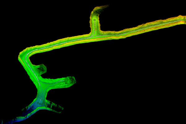
TruNorthe drones can function with an autonomous, beyond line-of-sight flight allowing them to safely enter and scan areas of high geotechnical risk, such as failed headings.
Personnel can use the captured data to assess the conditions and develop job hazard analyses and safe re-entry plans.
Ground Support Intelligence
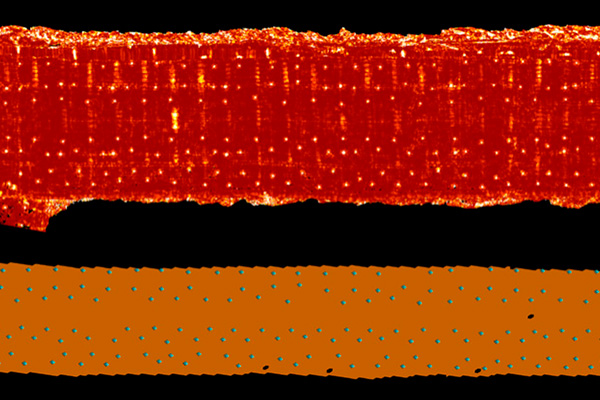
LIDAR can be used to record the void, structures, and ground support, prior to shotcrete application. This data can provide a baseline for future analysis and audits.
Conducting a second scan of the surface after shotcrete has been applied allows engineers to determine whether the application is within specification and matches the invoiced volume. This second scan can also be used as a baseline for detecting damage or movement in the shotcrete after development activities commence.
By contrast, traditional methods, which rely on drilling and measuring widely spaced depth holes, are time-consuming and inaccurate.
Access Falls-of-ground
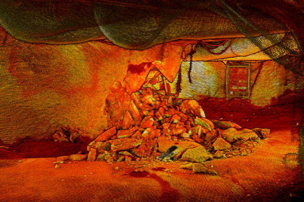
After a significant geotechnical event, assessing the area and developing a rehabilitation plan to make it safe to re-enter is a priority for mine owners.
Drone based LIDAR can be deployed to scan the area, without putting personnel at risk. Captured data can be used to produce visualizations, calculate the volume and surface area of the collapse, and determine whether adequate pillars remain. It can also form a baseline for deformation analysis, predicting future falls-of-ground and convergence activity.
All of this can be safely accomplished in a completely blacked out environment.
Exploration of Old Workings
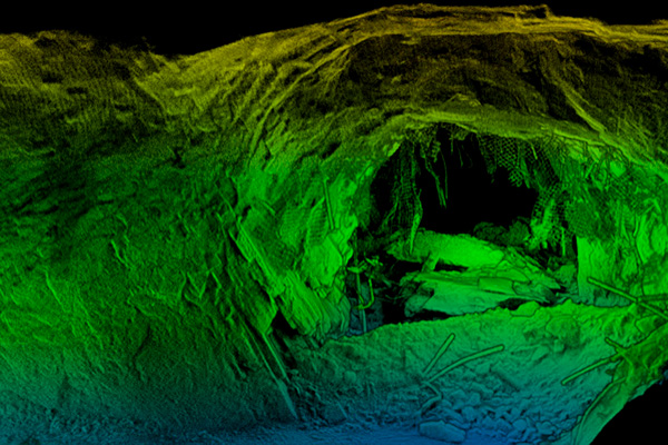
Abandoned mines are now being reassessed for recommencement, due to price increases in some commodities. Typically, these old mines have substandard ground support, which has further deteriorated over time.
Sending in an autonomous drone to capture data reduces the unknowns, by allowing engineers to complete a comprehensive risk assessment safely. They can assess the rock mass and structural conditions to identify and mitigate hazards before personnel enter the area.
Infrastructure As-Builts
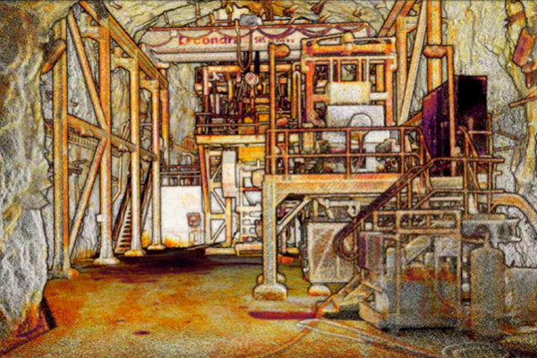
LIDAR can capture built environment in a flight or walking scans and all without additional light sources. Accurate and detailed as-built point clouds can be transformed into CAD plans of complex 3D structures quickly and easily.
Comparing consecutive scans allows engineers to detect whether changes have occurred between scans.
Stope Shape
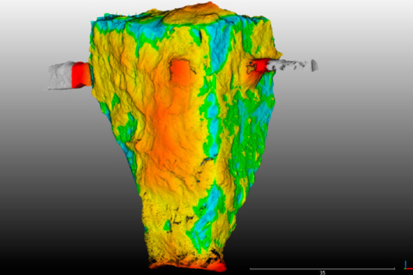
Drone and robotic LIDAR can deliver high resolution stope shape point clouds with uniform point density and minimal shadowing. Accurate stope data can improve mine efficiency by allowing drill and blast engineers to see how their initial drill pattern has performed. Subsequent patterns can be refined, to maximize ore body extraction, and improve material flow.
Stope Volume
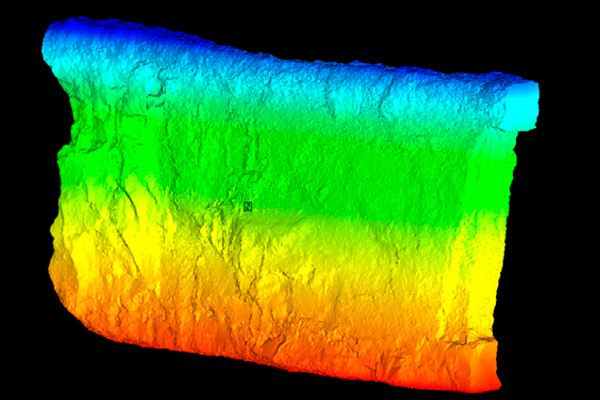
Our LIDAR delivers high quality point cloud data can enable geologists to analyze the final stope more accurately. Data can be used to reconcile production tonnes, quantify over and under-break and inform depletion modelling. Having access to accurate data makes it possible to quantify the expected grade of the stope with greater confidence and ensure material has gone to the correct ROM stockpile. In collaboration with the mill metallurgy, geologists can ensure target grades are blended and variability in EOM reconciliation is reduced.
Blast Performance
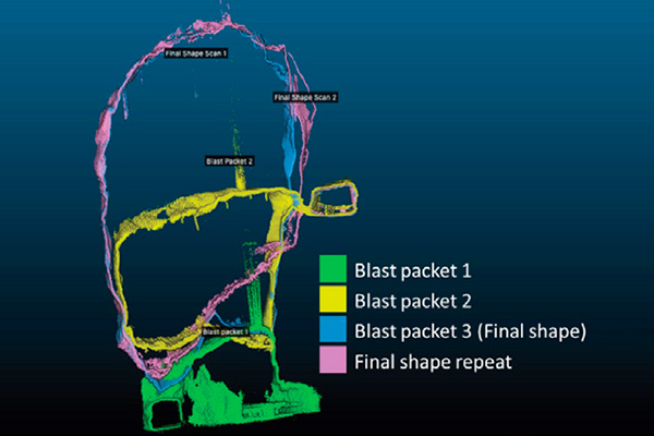
Using SLAM LIDAR to scan a stope at regular intervals during the extraction process can help to build a richer understanding of blast performance. Comparing scans over time makes it possible to identify emerging issues, such as fragmentation and over-break, that may affect the mucking rate or impact adjacent stopes.
Having access to this library of data allows engineers to compare extraction progress with the schedule and adjust downstream activities accordingly, thereby averting the complications and cost of equipment stand down.
Over & Under-Break
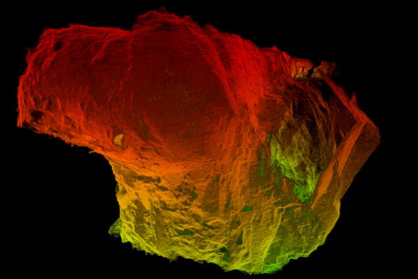
The value extracted from a stope is one of the key metrics for an underground operation. Using drone mounted LIDAR to scan stopes regularly can help to maximize this value.
Because of the precision and density of LIDAR point clouds, geotechnical engineers can conduct detailed back analysis on failures, identify the geotechnical mechanisms responsible for over and under-break with a high degree of confidence, and adjust their method to minimize the likelihood of re-occurrence.
Structure Detection
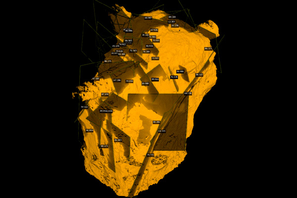
Our accurate, high-resolution LIDAR point cloud data can allow geotechnical engineers to identify structural traces and planes with greater confidence. Structural characteristics, such as dip and azimuth, persistence, roughness, and spacing of features can be extracted and used for rock mass characterization and design purposes.
Stoping relies on the stability of large un-supported walls so identifying structural features that may affect current and future stoping performance can improve stope economics.
Traditional scanning methods have not allowed this level of detailed analysis.
Backfill Height / Volume
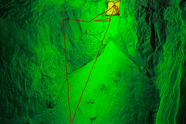
LIDAR scans can be used to monitor backfill heights and ensure backfill types are installed correctly. Rather than relying on bucket counts, schedulers are able to obtain an accurate measure of remaining stope volumes and can direct material accordingly.
Stope Dimensions
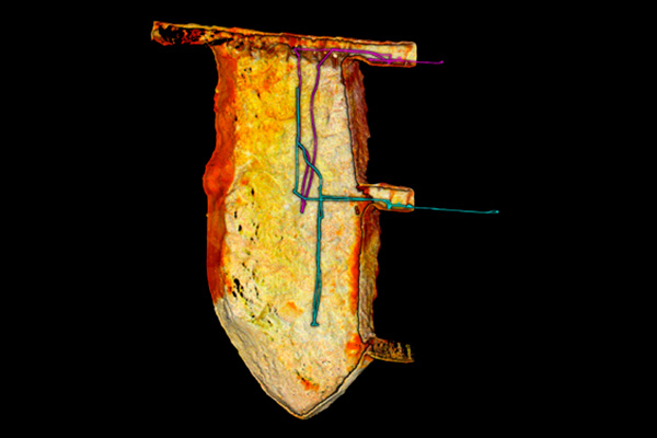
LIDAR scans can enable surveyors to maintain highly accurate void models. This is a statutory requirement for underground mines in many jurisdictions. Traditional CMS void modelling methods typically result in gaps in the data and this may expose surveyors to legal risk, in the event of an incident. Moreover, having accurate, high resolution spatial models of stopes limits the need for other technical teams to conduct their own inspections.
Brow Deformation
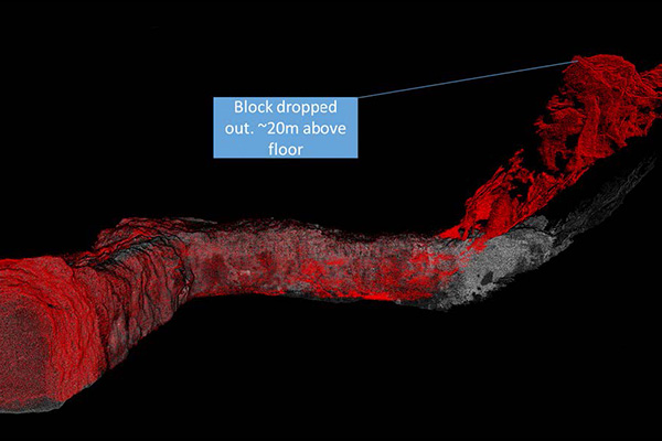
In the event of brow failure, drone or dismounted scans can be used to create a comprehensive picture of the affected area and extract detailed measurements of the damage. Engineers can use this intelligence to determine whether the area should be rehabilitated or abandoned. Traditional CMS methods cannot provide this level of clarity and obtaining the scans can put operators and equipment at risk.
Drawpoint Inspection
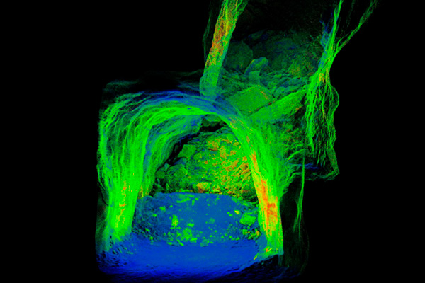
LIDAR scans can provide engineers with superior insight into oversize material and hang-ups at drawpoints, in stoping and caving mines. These phenomena pose a safety hazard to personnel and to the equipment used to clear them. Flown or attached to a loader LiDAR’s range and wide field of view capture can enable it to deliver scans which provide a better perspective of the blockage than those obtained via traditional CMS methods.
Vertical Infrastructure
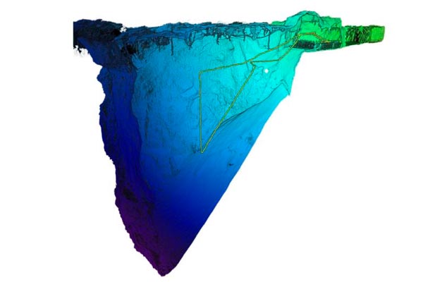
Orepasses and vent raises are essential but expensive infrastructure in underground mines. To maintain safe and efficient operations, mining and geotechnical engineers need to understand the effect of mining-induced and tectonic stresses on orepasses and vent raises. The traditional data collection process, involving C-ALS scanners and the drilling of inspection holes, produces incomplete, low-resolution scans of raises. It is time-consuming and expensive and very often not undertaken until significant failure has occurred.
By contrast, LiDAR scanning is cost effective, typically accounting for less than 1% of the raise bore/orepass excavation cost. It is also extremely efficient. For example, a 100 m (110 yd) raise can be scanned by drone platform in around 20 minutes.
These systems can be drone mounted or even lowered by existing winch or crane to scan longer features.
Vent Raise Inspection
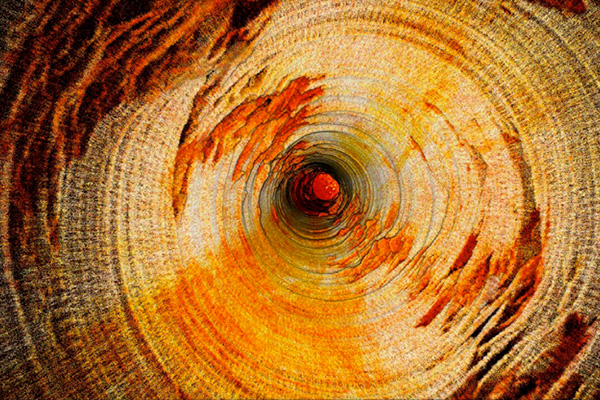
Ventilation is a critical component of any underground mine. LIDAR can scan vents easily and economically: by flight when the diameter of the vent is greater than four meters, and mounted in a protective cage and lowered on a tether when it is less than four meters.
Using our SLAM LIDAR system engineers can quickly create as-builts of ventilation systems, for comparison with the original construction specifications. Stress induced damage can be easily identified, and this intelligence can enhance geologists’ understanding of the deformation.
Orepass Inspection
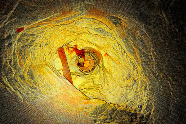
Maintaining the structural integrity of orepasses helps mine operators meet production targets. Regular inspections enable engineers to detect changes, deformation and blockages promptly, and to ensure no undercut is present at the tip head location. Lowered in a cage the SLAM LIDAR can scan orepasses hundreds of meters in length, quickly and easily, and produce accurate condition data that can be used to inform remediation decisions.
Raisebore Inspection
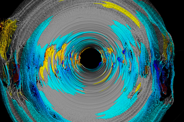
A raise must be inspected once reaming has occurred, to prepare for shotcrete lining, create a baseline for further inspections and to ensure it has been constructed to specification. Using the protective cage or drone attached units the LIDAR can be used to capture data to produce as-builts and condition reports quickly and economically.
By contrast, inspecting a raisebore using traditional CMS scanning methods is difficult and expensive.
Decommissioned Infrastructure Inspection
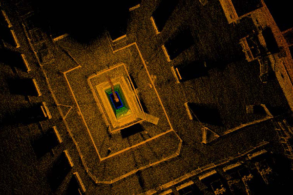
Old vertical infrastructure frequently lacks technical drawings or as-builts. The protective cage system or drone can be used to conduct condition inspections safely. The data captured can be used by engineers to identify hazards and inform remedial planning.
Geological Features
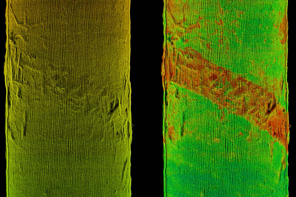
In underground mines, geological features, such as fractures, faults, lithology changes, mining stress and tectonic stress, can contribute to changes in rock mass behavior. Monitoring deformation and failure in raises, and determining whether remediation is required or cost effective, is a perennial challenge.
Analyzing LiDAR data can assist geologists to infer a wide range of geological features and improve their characterization of the rock mass.
This enhanced intelligence can be used to inform management responses.
Structual Analysis of Rasies
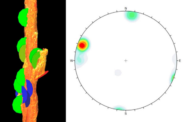
Local, mine or regional-wide structures can have a significant impact on raise performance. Lowered in a protective cage these same systems can be used to capture high resolution, multi-attribute data, to inform structural analyses of vertical raises and other underground voids. Identifying the structures, using Maptek PointStudio, Sirovision or CloudCompare, that have caused an existing failure can help geotechs assess the potential for more significant failure, and inform back analysis to improve future designs.